The
Douglastown Historical Review
|
The
Douglastown Historical Review
|
|
|
Issue
#1, Fall-Winter 1999, written by Al White, Toronto.
|
| First
Issue It might seem like a dumb idea to try and record the history of a town you never lived in. Where the physical records and the people who know the town best are a thousand miles away. It might seem dumb - but is it? Public
Archives of Canada staffmember, Dan Somers, wrote that: Over the past couple of years I have been researching my White and Briand family histories. Since most of the families in and around Douglastown have common ancestors, you find yourself researching other family histories as well. As a result of my research , I've been in contact with a great many of the descendants of Douglastown families. Some of these individuals still live in Douglastown while others moved away in search of work many years ago. They moved to places like New York, Ontario, Alberta, British Columbia and Califomia to name only a few. Today, the descendants of Douglastowners are living throughout North America. I figured if I shared what I knew and everyone else did the same, then at the end of the day - by means of the written word, we could prove that the expression "gone but not forgotten" was more than pretty words on a head stone. The question wasn't whether it was a good idea or not, but rather, how do we do it? A newsletter seemed the most appropriate forum to use because it's been my experience that the preparation of a history can be an ongoing proposition. Just when you think you know it, somebody comes along and adds some new facts or challenges established ones. A newsletter allows us to correct our mistakes and to share what we have learned as we go along. It invites people to make their own contributions - a family story, an old picture or just an encouraging word. I hope people will take the opportunity to make a contribution, whether you live in Douglastown or three thousand miles away. Whether the history you want to record was twenty years ago or two hundred years ago. Your contribution is vital. This first edition will cover the founding of the town. Future issues will profile the early families - Kennedy, Morris and Briand to name a few, the first church, the Irish are coming, shipwrecks and a lot more. It's only a beginning. But I hope as time goes by that the individual issues of the Douglastown Review will, when taken as a whole, represent a true history of the town of Douglas. And that this recording of the past, will in some small way reflect the reverence and respect that we have of those who came before us. So, continue reading and discover a bit of Douglastown's history. It's a spring day in June of 1785. Your standing at the mouth of the St. John river waiting for the arrival of Douglastown's first settlers - the Loyalists. The
Loyalists
The Loyalists felt to varying degrees the organized wrath of the revolutionary party. Those who spoke publicly against the revolution were tarred and feathered and many suspected of secret opposition were subject to surveillance from vigilance committees. No longer regarded as respected citizens, they became the objects of scorn, derision and persecution. Their property was confiscated, leaving them homeless and without any means of earning a living. In the end, they had to flee for their lives. In the Mohawk river valley, the home of William Kennedy, farms were burned and men, women and children were killed for supporting one side or the other. The war often pitted neighbour against neighbour. It was a time of "political cleansing". From 1777 until late in the 1780's people left their homes to the south and made their way to Canada. Most of the Loyalists who eventually came to the Gaspe coast made their escape along the Lake Champlain - Richelieu waterway. On their arrival they were housed in refugee camps at St. Johns, Montreal, Sorel,Yamachiche and Coteau du Lac. By the conclusion of the war there were nearly 5,000 people in the scattered camps. The men were organized into regiments; Butler's Rangers, Burgoyne's provincials and the King's Loyal Americans to name a few. They were responsible for the defence of Quebec and campaigned mostly in the state of New York. With the surrender of Cornwallis at Yorktown in October of 1781, the fighting for these men came to an end. The war ended with the signing of the Treaty of Paris in Sept.of 1783. The treaty gave official recognition to the United States as an independent nation.
Loyalist
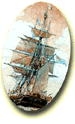
Town In his journal of this expedition, which is preserved among the Haldimand papers, Sherwood reported that although "the region around Gaspey, Point Peter and Percey is in general a succession of mountains as far as the eye could see, there were however some exceptions." At Gaspe, he found "some level land with good soil that was sparsely timbered." He felt it could support about 50 families. At the river St. John he found an equal quantity of land. Sherwood reported that he found the mouth of this river to be a "very pleasant and cornucopian place that could support about 40 inhabitants. The rivers abound with salmon, as does the whole bay with cod fish, eels, lobsters, etc.". Sherwood goes on to report that Point St.Peter was "extremely well situated for the fishery and would admit a considerable settlement for that purpose, the land being unfit for cultivation." Sherwood goes on to describe the various other places he visited including Pabos, Paspebiac, Bonaventure, Cascapedia and Nouvelle. He estimated that 1,500 families might immediately settle at these places while a further 200 families could settle between Perce and Gaspe. Sherwood report was completed by September and his findings were reported to the Loyalists at the various refugee camps. On June 9, 1784 a flotilla of eight ships carried 315 people to the Bay of Chaleur. One of Douglastown's first settlers, Thomas Morris was the captain of the hoy St. Johns that transported supplies and ten settlers. By the end of 1784 the number of settlers had increased to 435. Included in this number were disbanded troops from the 84th regiment and seamen who had served on the rivers and lakes of British North America.
A week later Cox wrote Haldimand again, stating that the Bay of Chaleur settlement had been established and that it was now his intention to build a town at the mouth of the St. John river in Gaspe Bay. This new town would be settled "by artificers not intending to participate in the fisheries". It was also his intention to take a grant of land for himself and to settle his family there. In September, he reported that he was still waiting for O'Hara to lay out the new town. A town he now referred to as St. Johns, Gaspe Bay. By this time, Thomas Morris and most of the other seamen who had brought the loyalists and discharged soldiers to their new settlement on the Bay of Chaleur had returned to Quebec for the winter. I have not found any documents of an official nature that suggests that Douglastown was settled in the fall of 1784. William Kennedy and his family were still in the refugee camp at Montreal in October of that year. It is hard to believe that they would of been forced to Gaspe so late in the season. But it may have happened. The loyalists who went to Cape Breton under Col. Cuyler including a Richard Miller who later came to Gaspe, left Quebec in October. The reason we have clear records for the settlement at New Carlisle and not at Douglastown is that there was a change in administration in the fall of 1784. Governor General Frederick Haldimand who had presided over the affairs of Quebec since 1778 sailed for England in October/1784. While most of General Haidimand's papers were carefully preserved and donated to the British Archives by a descendant, the papers of his replacements, Lieutenant Governors Hamilton and Hope were not. So the official record surrounding the early settlement of Douglastown is sparse. Sometime in the late fall of 1784 or in the spring of 1785 Felix O'Hara laid out two towns on the St. John river. He was assisted by Robert Simpson, a loyalist from New York who had returned to Gaspe with O'Hara from the new settlement at Carlisle. O'Hara produced two maps of the "proposed" new settlement which have been preserved by the Ministere des Ressources naturelles at Chariesbourg, Quebec. The maps are undated but I have been assured that they were produced in 1785. Nevertheless, I can't be sure whether they were produced before or after the arrival of the Loyalists. Of the two maps, map D21 f appears to be the original or "master" copy. On this map the two new towns are outlined and named, but the map does not contain any other details. My theory is that after he made an examination of the surrounding land, O'Hara went to Cox with his recommendations. The entrance to the St. John river was unnavigable by large ships, so O'Hara recommended that two towns be created, one on each side of the barachois. And just like they did at New Carlisle, the two men discussed the proposal (using the first map) and came to an agreement on how to proceed. At this point, O'Hara completed the survey of the country and town lots and produced the second map.. This later map now includes the country lots, the Globe reserve, as well as Cox's and O'Hara's land grants. If my theory of how the maps were used is correct, then that would suggest that the towns were named before the arrival of the Loyalists and named by O'Hara and/or Cox. For now it's just a theory. Hopefully one that can be proved sometime in the future. A
New Beginning It's unclear what happened next. At Cataraqui, near Kingston, Ontario the settlers arrived to find that their land wasn't surveyed yet. A tent city was created on the beach and the settlers waited several weeks for the surveyors to finish their work. It was only then that the draw for their land could take place. Although Cox and O'Hara were probably better prepared to handle the Loyalists than they were a year earlier, the construction of temporary shelters seems like the natural first step. Tents would have been quickly erected on the beach and if the ships had to return (they were in short supply) then buildings would have been constructed to house the supplies that accompanied the settlers. Each family brought with them their own tent and bedding. Clothing was to be provided for three years - nothing fancy, coarse cloth for pants and Indian blankets for coats. Boots were made from deerskin or heavy cloth. Axes, hoes, whip saws, chisels and drawknives were provided to families or groups of families. Muskets were shared with one gun being provided for each five men in the town. Seeds were supplied for the planting season. They included carrot, onion, beet, radish, watercress, celery, cabbage, turnip, parsley, peas, potatoes, Indian corn and wheat. In addition, each family was to receive food rations to last them until the following May. Each adult was entitled to a pound of flour and a pound of beef (or 12 ozs. of pork) per day. Children under the age of ten were allowed a half ration.
With their temporary homes erected and their supplies safely stored on shore the next priority for Cox and O'Hara was to distribute land to the settlers. The amount of land granted was based on the following formula: head of the family, 100 acres; for each member of the family, 50 acres; a single man, 50 acres; a private, 100 acres; a sergeant, 200 acres; a captain, 700 acres and so on. . For example, the family of William Kennedy, wife Mary and their six children would of been entitled to 450 acres. In the initial drawing, each man drew for only one town lot (one acre) and one country lot (100 acres). William Kennedy drew town lot 58. Do we know who these people were? Well maybe we do. In September and October of 1784 Major John Barnes was given the task of creating lists of loyalists and discharged soldiers who had or intended to take up the Kin's offer of free land. These lists were deposited in the Quarter Master Genereal's office, most of which have survived as part of the Haldimand Collection. Unfortunately the list for Douglastown didn't. A copy of the original list produced sometime before 1791 has been preserved by the Ontario Archives in Toronto. A contemporary alphabetical list made from this copy was produced by Elizabeth Ruch and published in 'The Loyalists of Quebec - A forgotten History'. I have reprinted the names for Douglastown below. Many of them left for Perce, Point St. Peter and Gaspe without ever settling in Douglastown. Some names on the list may never have made trip at all. We may never know for sure. As I said earlier, with their temporary homes erected and their supplies safely stored on shore the next priority was to draw for the land. This was done at random out of a hat. The draw was recorded and each man given a "Location Ticket". Location tick were not land titles or deeds. That was promised to come later. The ticket would simply have given the settler the right to occupy the lot indicated. I have not seen a location ticket for Douglastown but in 1820 at least a dozen existed. If one of our readers has preserved one of these tickets, then maybe they will permit us to print it in a future issue. For now, the sample on the right will have to suffice.
With the draw complete the time had come to build anew. Establishing a farm in the wilderness was no easy task. At times it must have seemed overwhelming. A cabin had to be built and a patch of land had to be cleared for a garden and a crop. Settlers would join together to construct a log house for each settler. These houses were small, the largest not more than 15 by 20 feet, built of round logs notched at the corners and laid one upon the other to a height of seven or eight feet. The gaps in the logs were filled with sticks and moss plastered over with clay. The roofwas made of split logs hollowed out. An opening for a door and one for a window was cut and a blanket did duty as a door until a few boards could be cut with a whip saw. The floor was made of split logs, the hearth of flat stones and the chimney of sticks plastered over with clay.
There wasn't any furniture. Basic necessities like a table, benches and a cupboard had to be hewed out with an axe or cut with a saw and then whittled into shape. For sleeping a platform of poles was placed across one end of the room about two feet above the floor. These poles were supported by inserting the ends between the logs in the wall. Mattresses were made of boughs, straw and feathers. Trees were "girdled or ringed" by peeling away the bark so that the tree died. Then the trees were cut down and burned. Slowly, small stump covered fields appeared around the cabins. Among the stumps, the Loyalists sowed their seeds. A garden was built as close to the house as possible, the plot surrounded by logs to protect it from insects and small animals. A fence constructed out of poles surrounded the perimeter to protect it from larger animals. During the years 1785 to 1800 most of Douglastown's first settlers abandoned the town. Some went to other places along the coast while others returned to Quebec and Montreal. Many of those who didn't leave, died. Life for the pioneer family wasn't easy. The crops failed in 1786 and 1787 became known as the Hungry Year in Canada. Between hunger and the rigors of pioneer life a lot of people didn't make it. On June 3rd, 1789 the Reverend Charles Inglis visited Douglastown. In his joumal he wrote that Douglas Town was a village of about twenty houses of which fifteen were inhabited. In spite of new arrivals, the town had gone from about twenty five families in 1785 to 1ess than ten by 1800. Ten years later it was down to six. But the pioneer spirit of those wh:) stayed helped Douglastown survive. It's golden years were yet to come. The
town gets a name I have also read the story that the town could of been named after one of its first settlers. But I have found no record to indicate a Douglas ever settled in Douglastown either. So, smarty pants how did Douglastown get it's name and what makes you think you've got it right. Well, I figure it this way. By the time Ferland visited the Gaspe all of the original settlers were dead. The story of the town's name simply got garbled in the retelling. So lets take a look at the ingredients of the Ferland story one at a time. We have a surveyor, the name Douglas and someone who ruined himelf in a land speculation scheme. The Surveyor: As I pointed out earlier, Douglastown was actually surveyed by Felix O'Hara with Robert Simpson acting as his assistant. There are several documents that bear this out.. So the town wasn't named after the surveyor; but it may have been named by the surveyor, after someone named Douglas. But what Douglas? During the years from 1801 to 1840 the Survey General's office was headed by a talented man by the name of Joseph Bouchette. In 1831 he published a book entitled "A topographical dictionary of the Province of Lower Canada". Under the heading for Douglas town Bouchette states "This town was laid out about the year 1785 and named after Admiral Sir Charles Douglas." Presumably, Bouchette's information was based on records in the Survey General's office and on his own visits to Douglastown many years earlier. So, who was this Charles Douglas and why would Douglastown be named after him?
Douglas is probably best remembered for having been in command of Admiral Rodney's flagship HMS Formidable in the naval battle of the Saintes in 1782. He is credited with taking the decisive action that won the battle. In 1783, Douglas was appointed cornmander-in-chief of the Nova Scotia station and remained in that command until 1786. His responsibilities included protecting the fisheries along the Gaspe coast. During the course of 1784 several letters were written between Lieutenant Governor Cox and Governor Haldimand where the name Douglas and the new towns at the mouth of the St. John river are interwoven. In the spring of 1784 American fishing vessels began setting up flakes, stages, etc. at Point St. Peter and Bonaventure Island. In a letter dated July 3rd, 1784 Cox asks Haidimand for instructions on how to deal with the Americans. It is in this letter that Cox first proposes to create a town for artificers at the river St. Johns, Gaspe Bay. Cox gets his answer in August. Haldimand instructs Cox to order the Americans away and to write to Douglas for assistance. Later on in the letter Haldimand tells Cox that he approves of the selection of the St. John river as the site for the next settlement. In a third letter dated September of 1784 Cox reports to Haldimand that he has asked Douglas for help in removing the Americans. He then goes on to say that he is waiting for O'Hara to lay out the new town at St. Johns, Gaspe Bay. Three letters - two themes: get assistance from Douglas and the new township on the St. John river. In June 1785, O'Hara writes Haidimand and from the contents of this letter it is obvious that UHara has had extensive contact with Douglas. He states Douglas' opinion on several matters and is aware of his trip to England. So, at the time of the creation of the towns of Douglas and Haidimand, the top two government officials for the Gaspe coast (Cox and O'Hara) are both in contact with Douglas and requesting his assistance. Is it really so hard to believe that they would name the town after someone they knew, someone whom they respected and depended upon for assistance. The Land Speculator: This is a little harder but I think it may have been Hugh Finlay. Finlay was a member of the Legislative Council and served on many committees including the powerful land committee which he chaired. In addition, he was Canada's first Post Master. It was in Finlay's office that the Loyalists signed their names for the June/ 1785 trip to Gaspe. Finlay himself was prevented from taking land in the Bay of Chaleur until after all of the Loyalists were settled. Even with all of his government positions, Finlay always appeared to be short of money. This may be the reason he got himself involved in a land speculation scheme. Finlay used his position on the land committee to gain approval of grants for as many as 24 townships. The scheme collapsed when a temporary halt on free concessions of township land was imposed. Desperate for money, Finlay had already sold 36,000 acres in Stanbridge township in advance. Under investigation for land speculating and unable to get titles for the land lie had already sold, Finlay was forced to mortgage his house and to pledge his salary to his creditors. Financially ruined and his reputation tarred, matters only worsened for poor Finlay. Other debts became due and he lost his position at the post office. He died a few years later in 1801 heavily in debt. I said earlier that all but one author had repeated the myth about the naming of the town. The exception was David McDougall who over he years has written many pieces on the Gaspe - many of which have appeared in the SPEC. McDougall expressed his doubts about the Ferland story in his article.
The Reference Library lists 234 titles under the heading of Loyalists. I guess you'll believe me when I tell you that I haven't read them all. The information concerning the Loyalists contained in this edition of the DHR comes principally from two "primers". The first is called "United Empire Loyalists and the American Revolution" by Allan Skeoch. The other is "Pioneer Life among the Loyalists in Upper Canada" by W.S. Herrington. The biography on Douglas and Finlay can be found in the "Dictionary of Canadian Biography". Sherwood's journal has been preserved in the Haldimand papers by the Public Archives of Canada in B-169. The correspondence between Cox, O'Hara and Haldimand can be found in B-64 and B-202.
I try not to make mistakes but mistakes will happen. If you find any errors then please let me know. If you have any questions, comments, ideas or if you would like to contribute material for a future issue (i.e. stories, pictures - copies only, do not send originals) then please send your correspondence to:
|
|||||||||||||||||||||||||||||||