Australia 2010


page 1 of 2 next page >
last page >>
IMG_1655  'Floodway' where the land is a bit low, with extra asphalt and depth markers.  Our first drizzle.  They have had no rain for 18 months.JPG
'Floodway' where the land is a bit low, with extra asphalt and depth markers. Our first drizzle. They have had no rain for 18 months
IMG_1668 Ashburton River, typical for the dry season.  Notice the depth markers.JPG
Ashburton River, typical for the dry season. Notice the depth markers
IMG_1669 Map of the Karajini area and the history of Nanutarra Station and Roadhouse.JPG
Map of the Karajini area and the history of Nanutarra Station and Roadhouse
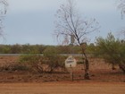
IMG_1673 Dogs' Dunny.JPG
Dogs' Dunny
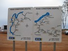
IMG_1675  Road conditions map at the Nantarra Roadhouse.JPG
Road conditions map at the Nanutarra Roadhouse
IMG_1683  Entrance to the Giralia Station where we had lunch.JPG
Entrance to the Giralia Station where we had lunch
IMG_1685  'Corrugated' (washboard) road into the homestead.JPG
'Corrugated' (washboard) road into the homestead
IMG_1687  Now a tourist farmstay lodge, from 1921-2003 Giralia was a 228,000 hectare sheep station.JPG
Now a tourist farmstay lodge, from 1921-2003 Giralia was a 228,000 hectare sheep station
IMG_1689  This original 1920's homestead was damaged in 1997 by Cyclone Vance (measured winds 267 kph, estimated 330 kph).JPG
This original 1920's homestead was damaged in 1997 by Cyclone Vance (measured winds 267 kph, estimated 330 kph)
IMG_1690  'School of the Air' schoolroom in the homestead, with a volunteer 'REVISE' relief teacher to help the mother who usually supervises schooling.JPG
'School of the Air' schoolroom in the homestead, with a volunteer 'REVISE' relief teacher to help the mother who usually supervises schooling
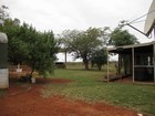
IMG_1691  Homestead work buildings, 1.JPG
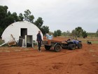
Homestead work buildings, 1
IMG_1692  Homestead work buildings, 2.JPG
Homestead work buildings, 2

page 1 of 2 next page >
last page >>